Blog Archives
Allt Troedrhiw-fer – Golygfa Epynt link
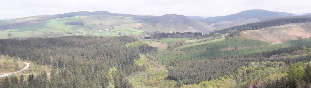
Follow this link which connects Halfway and Crychan forests. Enjoy the pastoral views over Cwm Gwennol as you freewheel down from Cefn Arthen. This trail links the Alt Troedrhiw-fer trail in Halfway to the Golygfa Epynt trail in Crychan. A link trail joins onto the Epynt Way.
 Allt Troedrhiw-fer – Golygfa Epynt link Map (737.8 KiB)
Link to the EPYNT WAY (905.7 KiB)
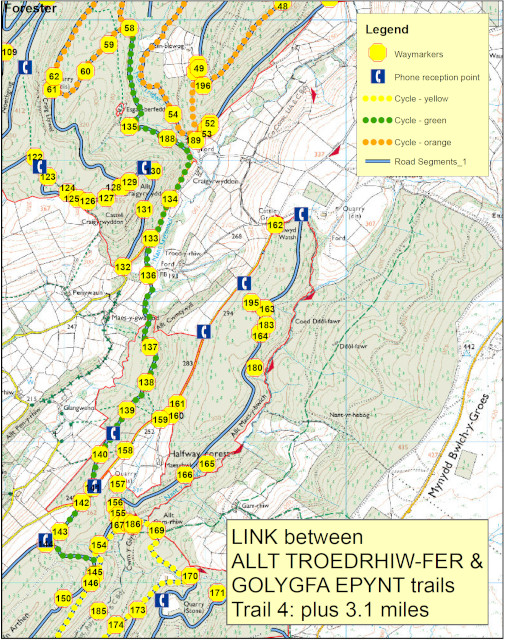
Allt Troedrhiw-fer – Golygfa Epynt link Map (737.8 KiB)
Link to the EPYNT WAY (905.7 KiB)
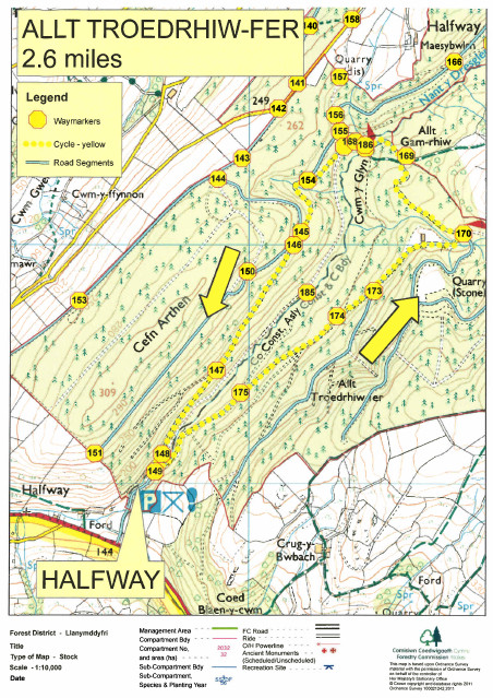
Allt Troedrhiw-fer
Follow the forest road over the waters of Nant y Dresglen before returning along the side of Allt Troedrhiw-fer. A link trail joins onto the Epynt Way.
Link to Epynt way currently closed due to fallen trees blocking the path and the danger of falling branches. An alternative route can be found by following the main forestry road around the quarry.
Allt Troedrhiw-fer Trail Map (634.1 KiB)
 Halfway Cycle Trail Allt_Troedrhiw-fer - GPX file (6.5 KiB)
Allt Troedrhiw-fer - Epynt Way link Map (657.8 KiB)
Halfway-Cycle Trail-Allt_Troedrhiw-fer
Profile
Description
Allt Troedrhiw-fer Trail Map (634.1 KiB)
Allt Troedrhiw-fer - Epynt Way link Map (657.8 KiB)
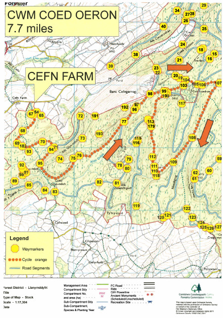
Cwm Coed Oeron
Gently climb up through the lovely woodlands of Cwm Dulais, and return past the lonely farmhouse of Cwm Coed Oeron.
Cwm Coed Oeron Trail Map (769.6 KiB)
Halfway Cycle Trail Allt_Troedrhiw-fer - GPX file (6.5 KiB)
Cefn Farm-Cycle Trail-Cwm Coed Oeron
Profile
Description

Cwm Coed Oeron Trail Map (769.6 KiB)
Brynffo – Esgair Fwyog
Including Extension
Length: 12.4 Miles 20.6 Kilometres
This cycle trail starts from Brynffo car park but as it goes through Esgair Fwyog you could start there.
Follow the stream down into Cwm Crychan, and then enjoy the open views as you reach Esgair Fwyog. Complete the loop on the quiet public road.
An extension to this trail with the Golygfa Epynt trail adds an additional 8.1 miles. This takes you into the heart of Crychan forest, with stunning views over the Epynt ranges. There is one short off–road section at the southern end where we advise you to walk your bikes. From the extension it is also possible to join up the Epynt Way.
Brynffo - Esgair Fwyog Cycle Trail - Map (2.1 MiB)
Brynffo – Esgair Fwyog Cycle Trail with Extension - Map (2.6 MiB)
Golygfa Epynt Trail link to the EPYNT WAY - Map (904.0 KiB)
Brynffo – Esgair Fwyog Cycle Trail - GPX file (14.4 KiB)
Brynffo – Esgair Fwyog Cycle Trail with Extension - GPX file (40.1 KiB)
Brynffo - Esgair Fwyog Cycle Trail with Extension
Profile
Description
Brynffo - Esgair Fwyog - Cycle Trail
Profile
Description
Activities in the Forest
Nicky Grist Stages 2025
Saturday 12th July 2025
www.nickygriststages.co.uk
Open access to the forest will be suspended during this motor sport event.
Beacons Rally 2025
19th and 20th July July 2025
Welsh Trail Riders Association
www.wtra.co.uk
Open access to the forest will be suspended during this motor sport event.
Roger Albert Clark Rally 2025
Thursday 20th and Friday 21sth November 2025
Website: http://racrmc.org/
Open access to the forest will be suspended during this motor sport event.