Crychan Forest Association
Esgair Fwyog Walk
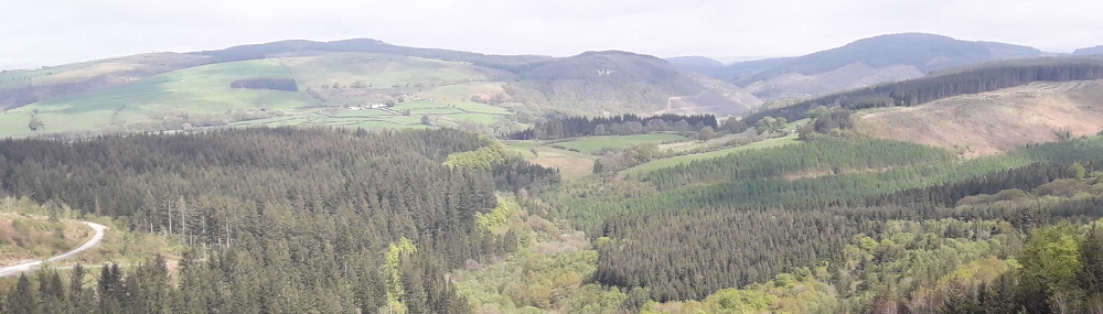
A moderate 4.5 mile (6.7km) walk in Crychan Forest from the Esgair Fwyog car park.
Take in the long views down the Tywi valley before reaching the secluded stream in Cwm Crychan. Look out for an almost hidden waterfall before the trail makes the gentle climb back to where you started at Esgair Fwyog.
 Esgair Fwyog Walk Map (2.0 MiB)
Esgair Fwyog Information Panel (2.1 MiB)
 Esgair Fwyog walking trail GPX file (13.6 KiB)
Esgair Fwyog Walk
Profile
No data elevation
Name:
No data
Distance:
No data
Minimum elevation:
No data
Maximum elevation:
No data
Elevation gain:
No data
Elevation loss:
No data
Duration:
No data
Description
Take in the long views down the Tywi valley before reaching the secluded stream in Cwm Crychan. Look out for an almost hidden waterfall before the trail makes the gentle climb back to where you started at Esgair Fwyog.


Activities in the Forest