Cwm y Glyn
Car Park: Halfway
Length: +3.7 Miles +6.2 Kilometres
Forestry work on this trail between 164 and 168 is now complete but the track has not been reinstated. So it is advisable to avoided this section by staying on the forestry road.
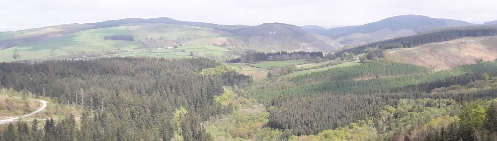
Follow this extension to the Cefn Arthen trail along the road up to the Army ranges before turning back along tracks with good views across Cwm y Glyn.
 Cwm y Glyn Trail Map (694.3 KiB)
 Cwm y Glyn - Horse Trail - GPX file (14.0 KiB)
Cwm y Glyn - CFA - Horse Trail
Profile
Description
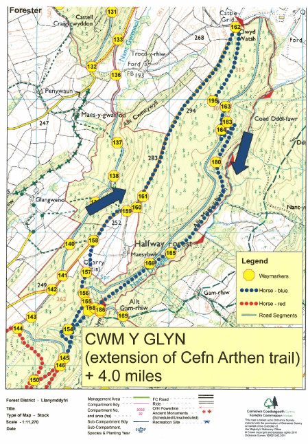
Cwm y Glyn Trail Map (694.3 KiB)
Activities in the Forest
Snowrun Enduro 2026
Sunday 8th February 2026
Welsh Trail Riders Association - Snowrun Enduro
www.wtra.co.uk
Open access to the forest will be suspended during this motor sport event.
Valentine’s Day Pleasure Horse Ride
14th - 15th February 2026
2 day Horse riding event organised by Endurance GB in Crychan Forest starting from Brynffo car park.
EGB event website
Drovers Enduro 2026
Sunday 12th April 2026
Halfway Forest
Welsh Trail Riders Association
www.wtra.co.uk
Open access to the forest will be suspended during this motor sport event.

Have you been on this trail? Please send us your photos of your trip to Crychan. If you experienced a major problem with a trail (like a tree down blocking a trail) please let us know so we can get it rectified.