Walking
Enjoy the tranquillity of the forest with its streams, glades and viewpoints on our walking trails. We have way-marked routes between 1 and 4 miles to take you though some of the most attractive parts of our woodlands. These are all suitable for families. A walk is way marked from each car park. Just check the info boards for all you’ll need to know.


Walking Trails
Walks from the four car parks at Halfway, Cefn Farm, Esgair Fwyog and Brynffo are easy to follow, by looking out for the wooden waymarker posts with symbols depicting a coloured footprint and direction arrow.
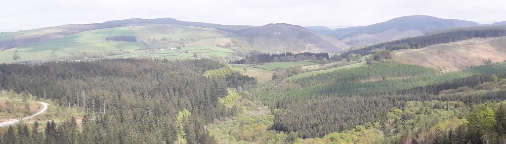
Halfway Walks
2 short walks in Halfway Forest.
2 gentle trails never far from the waters of the Nant y Dresglen.
Cefn Farm Walk
A moderate 2.5 mile walk in Crychan Forest from the Cefn Farm car park.
You’ll pass the ruins of the old 19th century farmhouse Glyn Moch before dropping down to the stream in Cwm Dulas. Try to imagine pigs rooting about here – as Glyn Moch means ‘valley of pigs’. Easy tracks return you to the start at Cefn Farm.
Esgair Fwyog Walk
A moderate 4.5 mile walk in Crychan Forest from the Esgair Fwyog car park.
Take in the long views down the Tywi valley before reaching the secluded stream in Cwm Crychan. Look out for an almost hidden waterfall before the trail makes the gentle climb back to where you started at Esgair Fwyog.
Brynffo Walk
A moderate 3.5 mile walk in Crychan Forest from the Brynffo car park.
Enjoy long views of the Cambrian Mountains to the north, before dropping into the sheltered valley of Cwm Crychan. You will follow the trail beside the stream, before climbing up through the trees, back to the start at Brynffo.
Other trails
Other trails for horse riders and cyclists are also suitable for walkers. Trail signage is gradually being changed so that waymarker posts will be badged with numbers only. No direction arrows will be present, so users should either download the trail maps or use GPX files.
Activities in the Forest
Drovers Enduro 2024
Sunday 28th April 2024
Halfway Forest
Welsh Trail Riders Association
www.wtra.co.uk
Open access to the forest will be suspended during this motor sport event.
The Headstock 500
26th May 2024
500km Mountain Bike Event
Details and Route
Gritfest 2024
Sunday, 23rd June 2024
A 3-day off-road cycling event.
Grit Fest Website
Nicky Grist Stages 2024
Saturday 13th July 2024
www.nickygriststages.co.uk
Open access to the forest will be suspended during this motor sport event.